Reccy makes gear for India's trails, heat, and monsoons — and we're on a mission to help 10 million Indians get out. This piece first ran in our newsletter, Get Out with Reccy. Subscribe on Substack to get the next one first.
Everyone knows Pangong. The turquoise waters, the 3 Idiots fame, the Instagram posts that made it Ladakh's most visited lake. But here's the truth: Pangong is spectacular, and it's also where every second tourist now goes.
Ladakh has other lakes. Lakes where quicksand meets volcanic blue. Where black-necked cranes outnumber visitors. Where the silence is so complete you can hear your heartbeat echoing across water that's existed for millennia.
These aren't "hidden gems" in the clickbait sense. They're remote, difficult to reach, and demand proper permits, planning, and respect for what high-altitude wilderness actually means. But if you're willing to venture beyond the standard circuit, Ladakh rewards you with landscapes that feel untouched by the 21st century.
This is your guide to six lakes beyond Pangong: Mirpal Tso, Yaye Tso, Ryul Tso, Chilling Tso, Kyagar Tso, and Tso Moriri.
CRITICAL SAFETY REQUIREMENTS — READ THIS FIRST
Acute Mountain Sickness (AMS) — Non-Negotiable
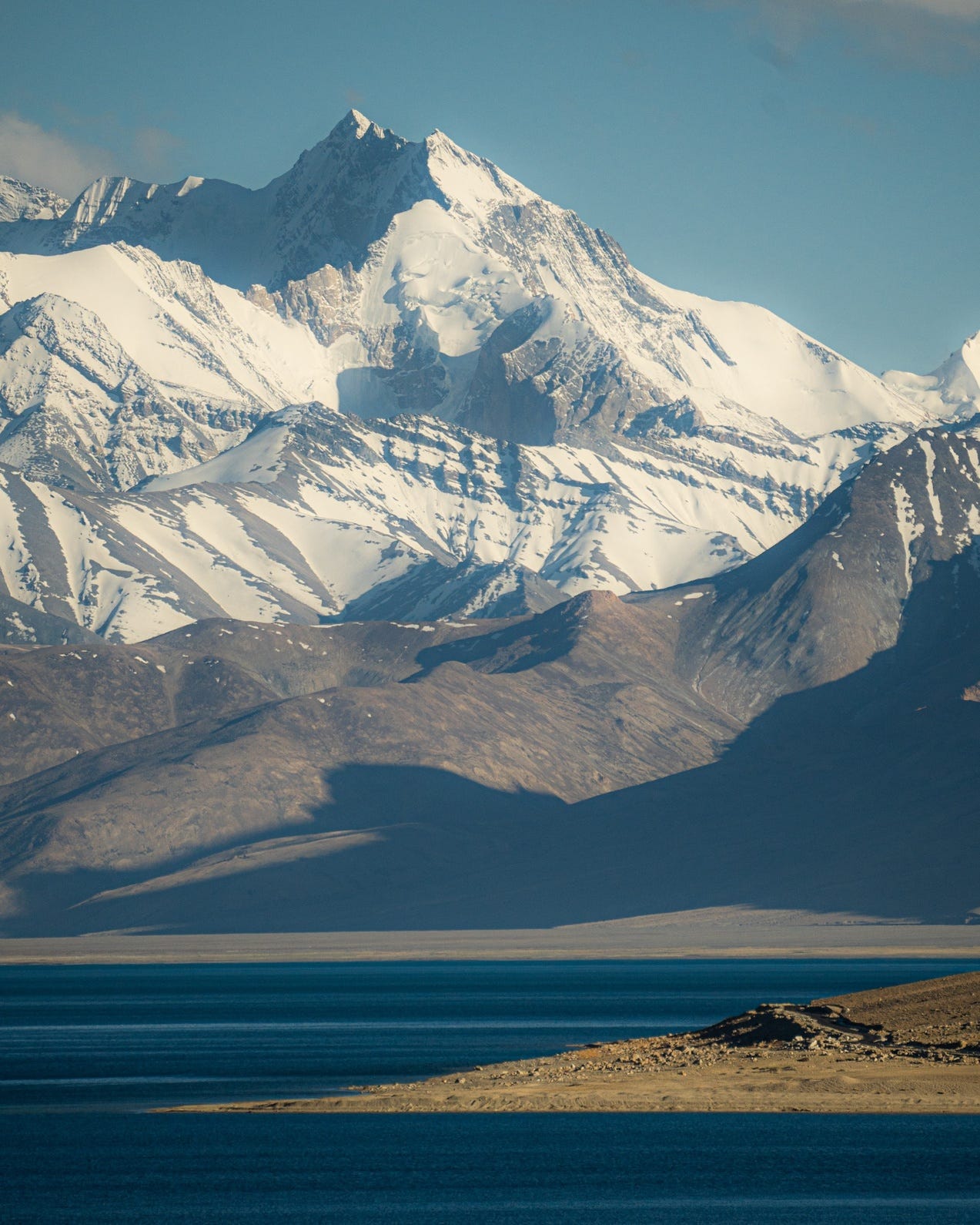
Every lake on this route sits between 4,500 and 5,000 meters above sea level. That's higher than Mont Blanc.
If you fly to Leh, you MUST spend a minimum of 2 full days (48 hours) in Leh city before attempting these lakes. This is mandatory from the Ladakh UT government.
Key AMS Points:
- Symptoms: Headache, nausea, breathlessness, fatigue. Severe cases: confusion, inability to walk, frothy cough (life-threatening).
- Prevention: Complete rest first 24 hours in Leh. Diamox 250mg twice daily (start 2 days before arrival — consult your doctor first). Drink 3-4 liters water daily.
- Only cure: Immediate descent to lower altitude. There are no hospitals near these lakes.
- Carry: Diamox, Dexamethasone, Aspirin, Paracetamol (after consulting doctor).
For comprehensive AMS information, symptoms, prevention, and treatment, read our complete guide: Acute Mountain Sickness (AMS): How to Recognize, Prevent, and Treat It in the Himalayas
Inner Line Permits Required
All these lakes are in restricted border zones.
For Indians:
- Inner Line Permit (ILP) — 3 weeks validity
- Cost: ₹400 (environment) + ₹20/day (wildlife)
- Apply: www.lahdclehpermit.in or DC Office, Leh
- Special permits needed for: Chushul route, Ryul/Chilling Tso
- Make 6-7 photocopies (checkpoints require them)
For Foreigners:
- Protected Area Permit (PAP) — 15 days validity
- Apply through registered travel agent in Leh only
- Minimum 2 people (solo travel not allowed)
Leave No Trace — Non-Negotiable
These lakes are ecologically fragile. Tso Moriri is a Ramsar Wetland Conservation Reserve — the world's highest. Yaye Tso is a proposed biodiversity heritage site. What you do here matters.
The Rules:
-
Carry ALL waste back. Every plastic wrapper, every tissue, every cigarette butt. There are no dustbins here. Pack it in, pack it out.
-
No human waste on shores or near water. Dig cat holes 200+ feet from water sources. Bury waste 6-8 inches deep. Carry toilet paper back in sealed bags.
-
No washing/bathing in lakes. These are drinking water sources for wildlife and Changpa nomads. No soap, no shampoo, no dishes in the water.
-
Camping on Tso Moriri lake banks is STRICTLY PROHIBITED — it's a protected wetland. Camp only near Korzok village with permission.
-
For all other lakes: Obtain camping permissions from Leh authorities before departure. Do not assume you can camp anywhere. Consult locals about safe, permitted spots.
-
Stick to established trails and roads. Fragile alpine vegetation takes decades to recover from tire tracks or footprints.
-
Do not disturb wildlife. Black-necked cranes (endangered), Tibetan gazelles, snow leopards, Kiang — give them space. No chasing, feeding, or approaching.
This isn't a request. It's respect.
Cultural Sensitivity
The Changpa nomads are some of the most hospitable people you'll meet. They herd pashmina goats at altitudes where most can barely breathe.
In return:
- Ask before photographing people or animals
- If offered tea or food, accept graciously (refusing is rude)
- Respect prayer flags, mani stones, monasteries
- Seek local guidance for camping — they know the terrain
- Do not disturb livestock or pastures
IMPORTANT DISCLAIMER
All permits must be obtained BEFORE departure from Leh.
- Inner Line Permits (ILP) for Indians
- Protected Area Permits (PAP) for foreigners
- Special permits for restricted routes (Chushul, Ryul/Chilling)
Camping permissions must be obtained from Leh authorities or locals BEFORE setting up camp. Do not assume any location is permitted for camping. Tso Moriri lake banks are strictly off-limits. For all other areas, ask first.
Failure to obtain proper permits can result in being turned back at checkpoints, fines, or worse. Plan ahead.
The Lakes
Mirpal Tso — The Sandy-Shored Lake
Location: Chumathang Valley, near Kaksang La
Altitude: 4,913m (16,122 ft)
What's unique: Sandy shores (rare), freshwater, royal blue water in summer
How to reach:
From Leh (205 km): Leh → Karu → Upshi → Chumathang → Mahe → Hora La → Kaksang La (8th highest motorable pass, 17,834 ft) → Mirpal Tso
From Pangong (90 km): Lukung → Merak → Chushul → Mirpal Tso
Critical notes:
- Special permit from DC Leh required (restricted border zone)
- No road to lake banks — view from main road or hike down
- Extremely desolate — DO NOT travel alone. Sharp stones, zero help for kilometers.
- Army checkpoint at Chushul-Nama often denies passage (unpredictable)
Stay: No accommodation. Nearest: Mahe village (24 km) — basic guesthouses. Or continue to Hanle/Tso Moriri.
Warning: Carry 2+ spare tires. Route notorious for punctures.
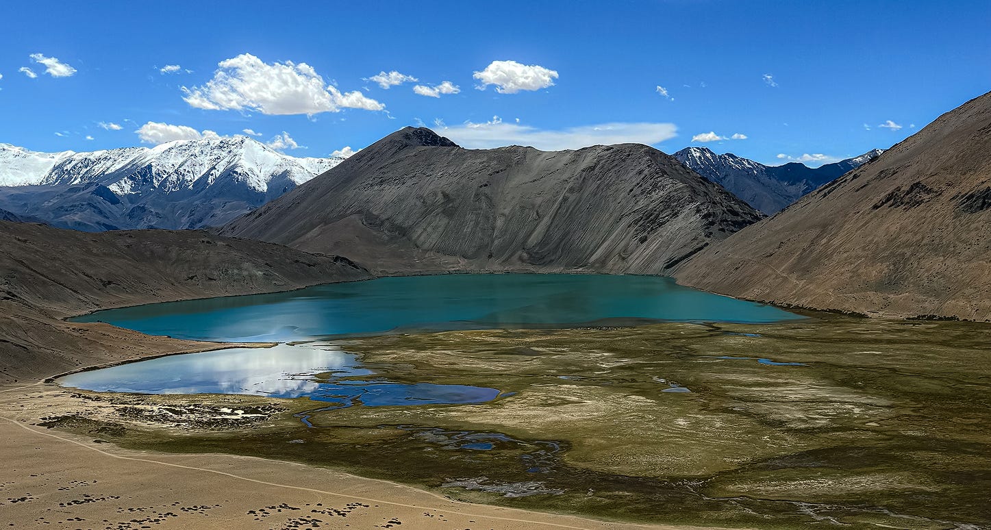
Yaye Tso — The Heart-Shaped Bird's Paradise
Location: Between Mahe and Chushul, visible from Hora La
Altitude: 4,988m (16,364 ft)
What's unique: Heart-shaped, volcanic lake. Proposed biodiversity heritage site (Ladakh's first). Critical breeding ground for black-necked cranes.
How to reach:
Leh → Chumathang → Mahe → Nurpa La/Thato La → Hora La → Yaye Tso (visible from pass)
Distance: 150-172 km
Road to Hora La is paved and doesn't require permit up to the pass. Drive down to lake shores possible, or hike from pass for vantage point.
What makes it special:
- Highest breeding site for black-necked cranes in India
- Yaye village nearby (monastery + nunnery)
- 60 sq km biodiversity site under SECURE Himalaya project
Critical safety:
- QUICKSAND near shores — do not approach water's edge
- Avoid shortcuts (vehicle damage)
- Hiking at 4,988m significantly harder than it looks
Stay: Yaye village (very limited), Mahe (22 km), or Korzok if combining with Tso Moriri route.
Ryul Tso & Chilling Tso — The Remote Twins
Location: Near Hanle/Nyoma, Changthang
Altitude: ~5,000m (16,400 ft)
Distance apart: 6 km
Most remote and difficult lakes on this route. Extremely restricted zone near border.
Ryul Tso: Brackish water
Chilling Tso (Kyun Tso): Freshwater
Routes:
- Korzok → Chumur → Ryul Tso
- Mahe → Nyoma → Nidar → Thit Zarbo La → Twin lakes
- From Hanle via Hanle-Ryul-Chumur road
Permits: Extremely difficult to obtain. Army checkpoints frequently turn travelers back. Success depends on border tensions.
What's special:
- Crystal clear water, perfect mirror reflections
- Hardy fish species survive despite extreme altitude
- Zero human interference — pure wilderness
- No settlements, no network, no infrastructure
Critical warnings:
- Marshes near shores trap vehicle tires — view from distance
- Travel in groups (non-negotiable)
- Bring all supplies — water, food, fuel, oxygen
Realistic assessment: Most itineraries plan for it but get turned back. Have backup plan.
Stay: None. Day trip from Korzok or Hanle only (if permits obtained).
Kyagar Tso — The Emerald Before Moriri
Location: Between Chumathang and Tso Moriri, Salt Valley
Altitude: 4,700m (15,420 ft)
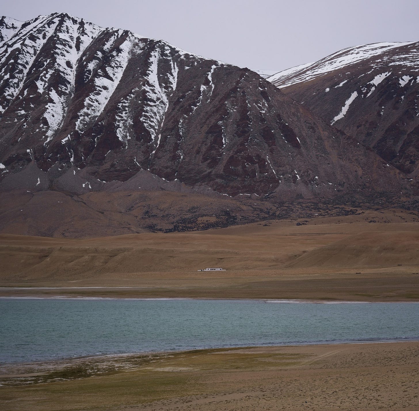
Small saline lake — first reward after crossing Namashang La pass. Emerald green/turquoise water against brown mountains. Color changes with weather (bright green in sun, grey-blue on clouds).
Special attractions:
- Buddhist mani stones with carved prayers
- Often mistaken for Tso Moriri by first-timers
How to reach: On route Leh → Tso Moriri via Chumathang. 30 km before Korzok, right after Namashang La. Most stop for photos.
Stay: None. Continue to Korzok (30 km) or camp with permission.
Tso Moriri — The Crown Jewel
Location: Changthang, 240 km from Leh
Altitude: 4,522m (14,836 ft)
Size: 26 km long, 3-5 km wide, 40m deep
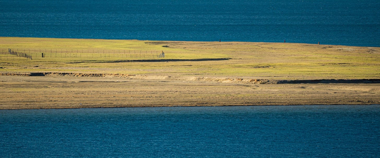
India's largest high-altitude lake entirely within India. Ramsar wetland reserve. World's highest Ramsar site. Arguably more beautiful than Pangong — higher, more dramatic peaks surrounding it.
Water slightly brackish but palatable. Fed by three glacial streams. Endorheic (no outflow). Freezes completely November-April (locals ice skate on it).
How to reach:
Route 1 (Most Common): Leh → Karu → Upshi → Chumathang → Mahe → Sumdo → Namashang La (16,270 ft) → Kyagar Tso → Korzok
Distance: 220 km | Time: 6-7 hours
Road: Good until Chumathang, deteriorates after Mahe
Route 2 (Via Manali Highway): Leh → Karu → Upshi → Rumtse → Tanglang La → Tso Kar → Puga → Sumdo → Korzok
Distance: 260 km | Time: 8-10 hours | Only if acclimatized (crosses 3 passes over 5,000m)
Route 3 (From Pangong): Shorter via Chushul → Tsaga La → Loma → Nyoma → Mahe (mention both Pangong and Tso Moriri on permit). Foreigners cannot pass Man-Merak village.
Checkpoints: Upshi (submit permit), Mahe Bridge (register + submit), Korzok entry (army post).
Stay:
- Korzok village (3 km from lake): Tented camps (₹900-3,000/night), homestays, guesthouses (Goose Homestay, Mentok Guesthouse, Lake View, Tsomoriri Camp & Resort, Nomadic Life Camp)
- PWD Guesthouse: Basic, limited
- Camping: Only near Korzok with permission, NOT on lake banks
Critical notes:
- No fuel Karu to Korzok (550-600 km loop). Refuel at Karu.
- Exiting via Manali: carry fuel for 500-550 km (next pump Tandi)
- Zero mobile connectivity. Nearest: Chumathang (70 km)
- Korzok: one of India's highest permanent settlements (4,572m), cultivated barley fields
The Complete Route
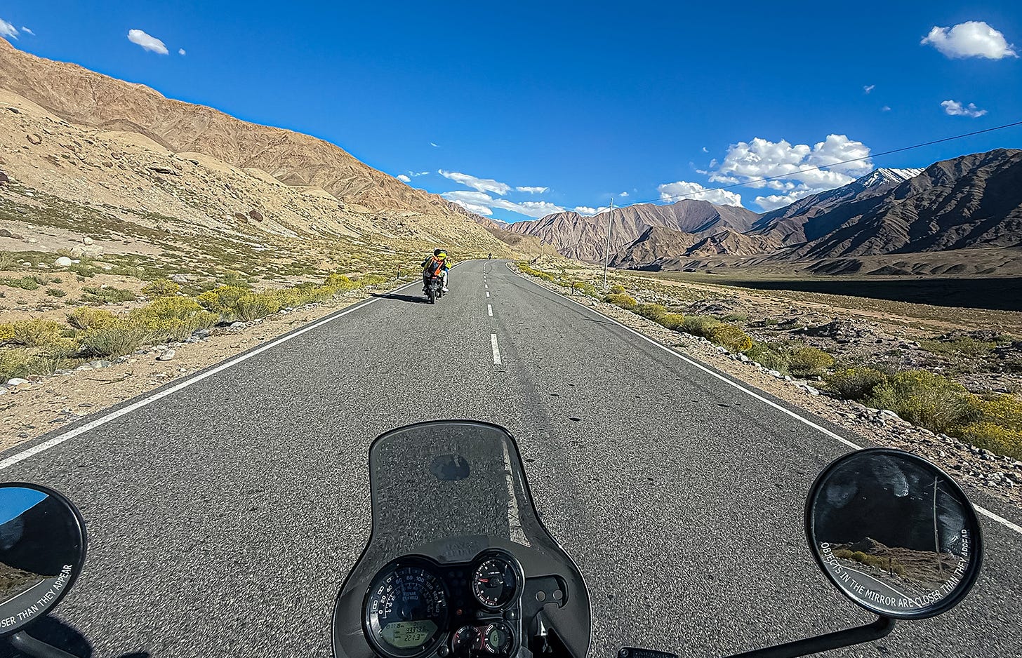
Suggested 7-8 Day Itinerary:
Day 1-2: Leh (Acclimatization) — complete rest Day 1, light monastery visits Day 2
Day 3: Leh → Pangong Tso (160 km, 5-6 hrs via Chang La 17,590 ft)
Stay: Spangmik/Lukung camps
Day 4: Pangong → Mirpal → Yaye Tso → Mahe (120-140 km, 7-9 hrs)
Multiple high passes, rough roads. Stay: Mahe guesthouses
Day 5: Mahe → Ryul/Chilling (conditional — depends on permits) OR direct to Tso Moriri
Backup: Mahe → Sumdo → Kyagar → Korzok
Day 6: Tso Moriri rest day — Korzok Monastery, wildlife photography
Day 7: Tso Moriri → Kyagar → Chumathang → Leh (220 km, 6-7 hrs)
Day 8: Buffer for delays
Fuel: Refuel Karu (last pump). No pumps for 550-600 km circuit.
Vehicle: 4x4 SUV mandatory. 2+ spare tires.
Connectivity: Zero at Mirpal/Yaye/Ryul/Chilling. Limited at Chumathang/Mahe.
Supplies: 5L water/person, energy snacks, warm clothes (nights freezing even in summer), oxygen cylinder (₹1,500-2,500 rental in Leh).
Best time: June-September
- June: Less crowded, possible snow on passes
- July-August: Warmest, light monsoon (landslide risk)
- September: Best weather, golden light
- October onwards: Roads closing, extreme cold
Budget Breakdown (7-8 Days, Leh to Leh)
Estimated Cost Per Person: ₹20,000-28,000
Breakdown:
Permits & Fees: ₹550
- ILP: ₹400 (environment) + ₹140 (₹20/day for 7 days wildlife fee)
- Photocopies: ₹50
Accommodation (6-7 nights): ₹5,000-8,000
- Homestays and camps at ₹700-1,200 per night
- Leh (1 night), Pangong (1 night), Mahe (1 night), Korzok/Tso Moriri (2 nights), Leh return (1 night)
- Book Korzok accommodation in advance (limited options)
Transport (Shared Taxi or Self-Drive): ₹8,000-12,000
- Shared taxi (4-6 people splitting ₹35,000-45,000 vehicle cost)
- Or self-drive rental + fuel divided by passengers
- Includes fuel for 550-600 km circuit (no petrol pumps Karu to Korzok)
Food (7-8 days): ₹3,500
- ₹400-500 per day for basic meals
- Dal-rice, Maggi, simple food at guesthouses and roadside dhabas
- Carry snacks from Leh (cheaper than buying on route)
Oxygen Cylinder & Essentials: ₹3,000-4,000
- Oxygen cylinder rental: ₹1,500-2,500
- Spare tire repairs/buffer: ₹1,000-1,500
- Basic medicines, warm clothes rental (if needed)
Budget Tips:
- Travel in groups of 4-6 to split taxi costs
- Carry cash — no ATMs after Leh
- Pack snacks and water from Leh
- Book Korzok stays early — limited rooms, prices surge in season
What's NOT Included:
- Flights to/from Leh (₹8,000-25,000 depending on city/season)
- Travel insurance (recommended: ₹500-2,000)
- Shopping/souvenirs
Who Should Go
Ideal for: Previous Ladakh visitors, comfortable with zero connectivity, adventure over comfort, photographers, physically fit.
NOT for: First-timers (do Leh-Nubra-Pangong-Tso Moriri standard circuit first), heart/lung conditions, requiring medical access, solo travelers, unprepared for rough 5+ hour drives.
Final Thoughts
Pangong is beautiful. It's also where tour buses go.
These lakes show you Ladakh before the camps, before the crowds. Yaye Tso where black-necked cranes breed undisturbed. Tso Moriri where Korzok monastery's 400-year-old walls face the same mountains since the 17th century. Mirpal Tso where emerald water meets volcanic sand and you might be alone for days.
The cost: serious planning, proper acclimatization, environmental responsibility, respect for how remote high-altitude Ladakh is.
If you're ready, these lakes show you why Ladakh is called the Land of High Passes — and why some places are worth the thin air, rough roads, and effort.
Get Out. Respectfully.
Sources
- Tso Moriri: lehladakhindia.com, discoverwithdheeraj.com, Wikipedia
- Mirpal Tso: frozenhighway.com, travelwithroosh.com, chalbanjare.com, roadexpeditions.com
- Yaye Tso: vargiskhan.com, discoverwithdheeraj.com, manoramayearbook.in, forumias.com
- Ryul/Chilling Tso: wanderon.in, techforwildlife.com, viacation.com, frozenhighway.com, vargiskhan.com
- Kyagar Tso: Wikipedia, viacation.com, hindfiri.com, charzanholidays.com
- Permits: lahdclehpermit.in (official), lehladakhindia.com, discoverwithdheeraj.com, exoticamp.com
- AMS: lehladakhindia.com, lehladakhtaxis.com, wanderon.in, discoverlehladakh.in, campsofladakh.com
Researched April 2026. Permit/road conditions change — verify with Leh authorities before departure.